Mural at the Stanton Street Bridge in downtown El Paso. (Sergio Chapa/Borderzine.com)

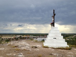
Last stop, El Paso and Ciudad Juarez

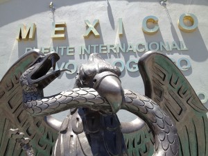
I’m going to admit now. There is no way to describe El Paso in a single blog but I’ll try my best. With close to one million residents, El Paso is the biggest city on the Texas side of the border. But it’s also filled with many contrasts making it one of the most complex and intriguing. The border city is home to four international bridges and one international railroad crossing.

Storm clouds rolled in from the mountains and then over Highway 90. (Sergio Chapa/Borderzine.com)

Highway to El Paso

After several days on the road, Lupita and I realized that we had fewer days ahead of us than behind us. It was more than 100 degrees when we left the Rio Grande River plain in Presidio. But it was a steady climb into the mountains as we headed north on U.S. Highway 67 back to Marfa. In the rear view mirror, storm clouds could be seen coming in over the mountains of Mexico. The wind was picking up and the higher the elevation, the cooler the temperature.

The Rio Grande River near Lajitas, Texas. (Sergio Chapa/Borderzine.com)

The River Road

Lupita and I were sad to leave the magical mountain town of Terlingua but our journey across the border had to continue. We set course on FM 170, which is known as the “River Road” because it runs parallel to the winding Rio Grande River for 120 miles. The folks at the cafe in Terlingua told us that the road was one of the most beautiful in Texas, so we were eager to see it for ourselves. It didn’t take us long to reach the town of Lajitas, a resort town with an official population of 50 people. Just the day before, we had seen the majestic natural beauty of Big Bend National Park and the ghost town of Terlingua.

You can cross on foot or pay a couple of bucks to be taken across in a row boat. (Sergio Chapa/Borderzine.com)

Big Bend: A park, a ghost town and crying rocks

After a hearty breakfast, Lupita and I set out for Big Bend National Park and the Boquillas border crossing. It was a two-hour drive with no cell phone service to the town of Study Butte where we made a pit stop. We were puzzled to watch a woman mumbling to herself and waging an unceasing war with a flyswatter to kill flies on a bench outside the store. For every fly that she killed, five more seemed to take its place. It was a 100 degrees and seemed too hot to expend that much energy on anything.

The Pecos River empties into the Rio Grande River. (Sergio Chapa/Borderzine.com)

The mysterious Marfa Lights

This is the only stretch of our trip where we did not cross the border. There are some 250 miles separating the Amistad Dam International Border Crossing from the one border crossing inside Big Bend National Park. Our journey continued into a changing landscape, one that was becoming more arid but we did get to see a brief summer thunderstorm and a rainbow. Lupita and I took it as a sign of good fortune on our trip. Despite the brief rain show, the drive along U.S. Highway 90 was one into the Chihuahuan Desert, a drive into the Great American West.

The beautiful Rio Grande River at the foot of Amistad Dam. (Sergio Chapa/Borderzine.com)

In the Del Rio area a clean Rio Grande River alternated in color from emerald green to sapphire blue

It was hard for Lupita and I to leave Eagle Pass. We had only spent one night there and there was so much more to see. But our trip along the border needed to continue. We took U.S. Highway 277 North, a Hill Country Highway that hugs the Rio Grande River. It’s only a one-hour trip but we drove through the towns of Elm Creek and Quemado as well as pecan farms and ranches.

The bleak highway between Laredo and Eagle Pass is filled with shrub buses, natural gas well and oil wells. (Sergio Chapa/Borderzine.com)

Eagle Pass, Texas to Piedras Negras, Mexico and back: Oil wells, fracking, a night at a Native American casino, and a monument to the swallows on the Mexican side

Lupita and I left Laredo and drove into the undiscovered country. Both of us had been to Laredo and Nuevo Laredo several times in past. But neither one of us had been to Eagle Pass before. We took a slight detour away from the border to head north on U.S. Highway 83, the same highway that goes through the Rio Grande Valley and continues through the heart of Texas and all the way north to the Canadian border. But we were only taking it to Carrizo Springs. Eagle Ford shale

Just north of Laredo, Highway 83 is a sun-bleached road where the vegetation turns from mesquite forest to thorny scrub brush. Unlike the vast brush country of deep-South Texas, there are not vast groups of immigrants crossing to bypass Border Patrol checkpoints.

A picnic area overlooking the Rio Grande River in northern Zapata County, Texas. (Sergio Chapa/Borderzine.com)

Webb County – From the city of Zapata to Laredo, Texas

El Cenizo

There is little between Zapata and Laredo other than hills, thorny brush, melon farms, ranches and natural gas wells. Lupita and I did make a pit stop at a picnic area atop a hill that overlooks the Rio Grande River near the Webb County line. Texas flag picnic tables overlook the river under stone and wooden pavilions. It was a lonely but scenic spot where we saw numerous butterflies swarming around flowering plants that grew on top of the hill. Following the highway west brings travelers to the twin communities along the Rio Grande River: El Cenizo and Rio Bravo.

Outdoor shrine to Virgen de Guadalupe in Falcon Heights, Texas. (Sergio Chapa/Borderzine.com)

Zapata County – A study in contrasts

Lupita and I left the historic City of Roma and took the Zapata Highway heading west. The next major landmark along the border is Falcon Lake. The 83,654-acre reservoir was created in 1954 when a dam was built along the Rio Grande River just a few miles west of Roma. Falcon Lake stores water in a drought-prone area of the border for human consumption, agriculture, hydroelectricity and recreation. There are several tourist sites around the lake on both sides of the border.

Santa Cruz in Rio Grande City, Texas. (Sergio Chapa/Borderzine.com)

Starr County

Mine and Lupita’s trip continued west into Starr County. With only 62,000 inhabitants, Starr County is nicknamed the “Hill Country of the Rio Grande Valley.” It’s easy to understand why. The four counties of the Rio Grande Valley are flat, with rich soil created from the Rio Grande River floodplain. But Starr County is more arid, hilly and rocky.

Bienvenidos a Mexico en Nuevo Progreso, Tamaulipas. (Sergio Chapa/Borderzine.com)

South Texas’ Hidalgo County: Winter Texans, citrus, micheladas, corruption and a chance to buy an international border bridge

Our journey across the Texas border continued in Hidalgo County. With close to 800,000 inhabitants, Hidalgo County is one of the most populous along the border and can be split up into three zones: northern, central and southern. The northern zone is sparsely populated with vast ranches dotted by oil, gas well and even a chain of salt lakes. Northern Hidalgo County is also a springboard for illegal immigrants from south of the border and through the unforgiving brush of South Texas. The central zone, which is cut in half by the newly named Interstate 2, is densely populated.

Los Indios, Texas. Transmigrantes companies are big business in Los Indios where Central American immigrants fill up buses and other vehicles with used clothes and toys and take them back to their home countries. (Sergio Chapa/Borderzine.com)

Space commerce, oil discoveries, Central American transmigrantes and a spiffy new highway along northern Mexico are transforming the Brownsville-Matamoros corridor

BROWNSVILLE-MATAMOROS – Our nine-day journey started in the southernmost tip of Texas just east of where the Rio Grande River empties into the Gulf of Mexico. Cameron County is home to more than 406,000 people and is one of four counties that make up the Rio Grande Valley. It’s a beautiful part of the border, one filled with great natural beauty. But there are also bleak industrial landscapes mixed in with rich farmland and neighborhoods both rich and poor. Mexico’s bloody drug war and kidnappings have definitely taken its toll on American tourism south of the border in Mexico’s State of Tamaulipas.

Our goal was to see every international border crossing along the Texas-Mexico

It was a trip that only lasted nine days but one that I’ll never forget for the rest of my life. I was born in raised in Texas and have lived for many years along the border. But I’ve never seen the entire Texas side of the border until I took a trip with my friend Lupita. I’m a journalist working for KGBT-TV in Harlingen and she’s a government professor at the University of Texas at Brownsville. Our work using social media to cover and research Mexico’s drug war overlapped in many areas.